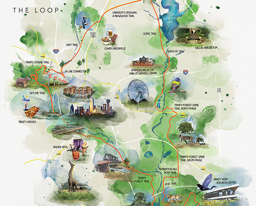
Skyline Trail
The Trinity Skyline Trail is a hard surface trail with alignments bringing visitors close to the Trinity River in the Dallas Floodway and featuring spectacular views of downtown Dallas. The 4.6 mile trail is perfect for hiking and biking. There are future plans to connect this trail to the Santa Fe Trestle Trail near 8th Street and Corinth Street once all construction projects in the area are completed. This entire system will also connect to the Trinity Strand Trail upon its completion. (Please heed all construction and warning signs when utilizing trails.)
News About This Trail

The Trinity Skyline Trail is a 4.6 mile, hard-surface trail perfect for hiking and biking. Near the Trinity River with a view of downtown.

To help you stay in the Loop with our latest project updates we’re upping our social media game. Follow The Circuit Trail Conservancy on social media. We’re on Instagram, Facebook, Twitter,…
I hope you have been staying warm through our cold snaps. As I’ve ridden the trails throughout the winter months, I’ve thought about our vision for The Loop Dallas and…